So I’ve been putting off writing this post for like three months because every time I sit down to rank Kitsap’s “best” hikes, I second-guess myself halfway through and delete everything. Two weeks ago I had Green Mountain at number four. Last Tuesday it was number one. This morning I almost put Guillemot Cove at the top just because I hiked it yesterday in perfect light and I’m still riding that high.
But my friend Sarah (who hikes way more than I do and has way better opinions about these things) told me to just commit to something already, so here we are. This is my current top ten. Ask me again in February when I’m knee-deep in mud and hating everything, and this list might look completely different.
Also—fair warning—I’m not trying to write some generic travel blog thing here. This is based on trails I actually hike, regularly, sometimes too often because I’m bad at exploring new places. If you want algorithmic SEO garbage about “Kitsap’s hidden gems,” there are plenty of those sites. This is just… the trails I keep going back to, ranked by a guy who’s gotten lost on half of them.
Quick thing before we start: I’m assuming you own rain gear that actually works, because if you’re waiting for sunny days to hike in western Washington, you’re gonna hike about six times a year. Also bring more water than you think you need. I cannot stress this enough. I’ve been hiking for years and I still constantly underestimate this.
Number One Is Gonna Make People Mad
1. Green Mountain State Forest (Gold Creek Trail)
I know. The most popular trail at number one feels lazy, right? Like I’m just picking the obvious choice. But hear me out—last September I dragged my skeptical brother-in-law (who’s more of a “beer and football” guy than a “hiking and nature” guy) up Green Mountain, and when we got to the summit he just stood there for like ten minutes not saying anything. Then he pulled out his phone and took maybe forty pictures of the Olympics.
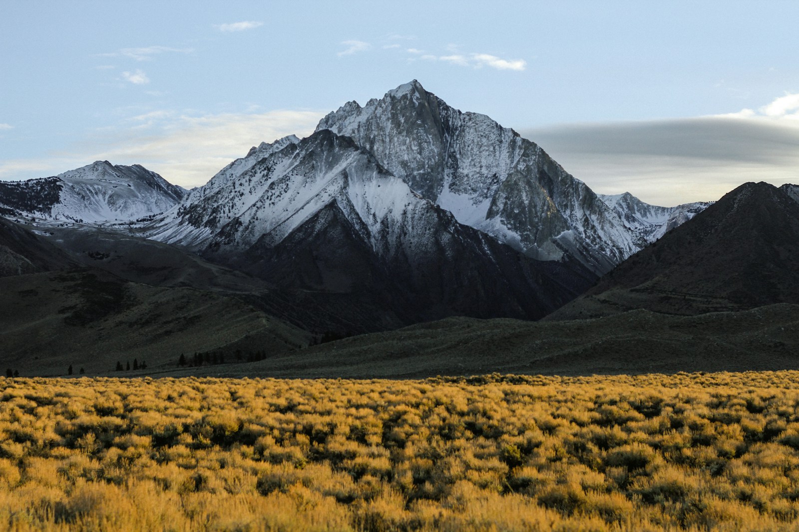
That’s the thing about Green Mountain. It’s about 5 miles roundtrip with 1,000 feet of elevation gain, which is enough to feel like actual hiking without destroying you. And the payoff at the top is legitimately stunning—Seattle skyline to the east, Olympics to the west, Hood Canal snaking below you, and on really clear days you can see Rainier.
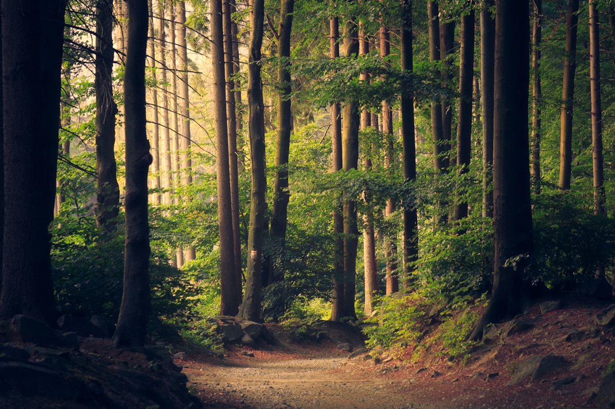
The Gold Creek Trail starts in this kind of ugly logged area (it’s a working forest, so there are stumps and slash piles and sometimes active timber operations), but once you get into the actual forest it’s gorgeous. Bigleaf maples, madronas with that papery bark that glows orange in the fall, salal everywhere. The trail’s well-maintained but rocky in spots.
My first time up I made the incredibly foolish mistake of bringing a single water bottle in August. By the time I reached the summit I was so thirsty I was eyeing other hikers’ CamelBaks like a dehydrated cartoon character. A very nice older couple offered me water and I maybe drank too much of it out of desperation. Not my finest moment.
The Plummer Trail loop on the way down is excellent—it’s got this incredible view of Hood Canal and Lake Tahuya where you can sit on a rock and just breathe for a while. But heads up: these trails are multi-use, so you’re sharing with mountain bikers, horses, and dirt bikes. The dirt bikes always scare the hell out of me even though I know they’re coming. They’re usually respectful but the sound echoing through the trees still makes me jump every single time.
There are actual bathrooms at the summit, which feels weirdly luxurious. The Washington Trails Association has detailed directions if you’ve never been.
Oh, and parking can be tight on weekends. I once had to wait 20 minutes for a spot, which I spent eating trail mix in my car and questioning my life choices.
2. Guillemot Cove Nature Reserve
Okay so this might actually be my favorite hike in Kitsap, which is why I almost put it at number one, but then I chickened out because I worry people will think I’m being contrarian.
Guillemot Cove is 184 acres of forest and beach on Hood Canal, with trails winding through these massive moss-covered bigleaf maples that are over 200 years old. The whole thing feels like a fairytale. I’m talking Miyazaki-movie levels of atmospheric forest vibes.
The catch—and it’s a big catch—is that the trail goes DOWN first. Steeply down. About 350 feet of elevation loss, which sounds manageable until you realize that means 350 feet of elevation gain on the way back after you’ve spent two hours exploring the beach and your legs feel like wet noodles.
But god. The beach. There’s this old beach house slowly being reclaimed by the forest, and the famous “Stump House,” which is literally a giant hollowed-out cedar stump with a roof that someone lived in during the Depression. Every time I see the Stump House I think “that’s the most Pacific Northwest thing I’ve ever seen” and then I remember I thought that last time too.
The Olympic views from the beach are just WOW. The Brothers peak just dominates the horizon across Hood Canal. At low tide you can poke around in tide pools, watch guillemots (those funny penguin-looking seabirds) diving, and generally feel like you’re on some remote island instead of twenty minutes from Silverdale.
One time I hiked down in April after a huge rainstorm, confident in my “waterproof” boots. Turns out the meadow near the bottom floods after heavy rain, and my boots were more “water-resistant-ish.” I spent the hike back with completely soaked feet making that awful squelching sound with every step. My friend Nathan will not let me forget this.
Also dogs aren’t allowed here, which I found out the hard way when I showed up ready to hike with my buddy’s yellow lab. We had to turn around. The lab was devastated. I was devastated. It sucked. But it’s a nature preserve focused on protecting bird habitat, so it makes sense.
The National Park Service has great info on preserving sensitive ecosystems like this one.
3. Grand Forest (Bainbridge Island)
I know Bainbridge is technically separate from mainland Kitsap but it’s still Kitsap County, so it counts. Fight me.
Grand Forest is 240 acres with miles of relatively flat trails through second-growth forest. The Main Trail loop is only about 1.5 miles, which makes it perfect for those days when you want to be in the woods but don’t want to commit to a whole thing.
What I love about Grand Forest is how quiet it feels even though it’s popular. The trails are wide, the canopy is thick, and there’s this one spot on the Ron Williamson Trillium Trail where the light filters through just right and everything smells like cedar and wet earth and you remember why you moved to the PNW in the first place.
I’ve hiked here probably thirty times and I still find trails I haven’t explored. The Forest to Sky Trail connects to Battle Point Park if you want more mileage, and there’s Grand Forest East with another 2.9 miles of trails. The whole system is great for just… wandering.
Parking sucks though. There are only about 10 spaces at Miller Road and they fill up fast on weekends. I’ve circled that parking lot more times than I want to admit. Pro tip: go early or go on a Tuesday.
4. Clear Creek Trail (Silverdale)
This is my “I have 45 minutes before I need to be somewhere” hike. Clear Creek is an extensive trail network in Silverdale that follows a salmon restoration area along Dyes Inlet. Mostly flat, mostly easy, totally accessible for after-work rambles.
The cool part is watching salmon spawn in the fall. I’m not a huge fish person but there’s something mesmerizing about standing on a bridge watching coho salmon fighting their way upstream. Very circle-of-life, very humbling.
The trail markers could be way better—I’ve gotten slightly lost here more times than I should admit for a trail system in the middle of town. But that’s kind of part of the charm? You can make it a 2-mile loop or a 6-mile exploration depending on which random spur trails you decide to follow.
Spring has incredible wildflowers (trilliums everywhere). Summer is shady and cool. Fall has salmon and yellow leaves. Winter is just… wet. So wet. But still pretty if you’re into moody Pacific Northwest aesthetics.
I saw a heron here last week that was at least three feet tall and did not give a single shit about me walking past. Just stood there in the creek like a statue judging my life choices.
5. Illahee State Park & Preserve
Illahee has these serene Puget Sound waterfront views and well-maintained forest trails that give you a little bit of everything—beach walking, old-growth forest, some actual elevation gain if you want it.
The Illahee Preserve trails (separate from the main park) go deeper into the forest. I hiked them last spring following what I thought was a super obvious loop trail and somehow ended up on what was definitely a mountain bike route, completely turned around. The mountain bikers were very polite about my confused presence. I was not polite about the trail markers, which barely existed.
But the old-growth trees make up for the navigation issues. We’re talking massive Douglas firs and cedars that make you feel appropriately insignificant. If you want to learn more about why old-growth forests are special (and where to find them), I wrote this whole nerdy deep-dive about PNW old-growth.
The beach section is great for kids. I’ve seen families down there building driftwood forts and hunting for crabs in tide pools. Very wholesome.
6. Port Gamble Forest Heritage Park
I hike here a lot, probably too much, which definitely biases my opinion. Port Gamble is a working tree farm that allows public access, with seriously extensive trail networks ranging from wide forest roads to technical singletrack.
The problem with Port Gamble—and it’s a real problem—is navigation. The trails could be way better marked. I’ve gotten completely turned around here at least five times. Once I added an extra three miles to what should’ve been an easy 4-mile loop because I missed a junction and just… kept walking. My phone was dead. I had no map. I just committed to the wrong direction and hoped for the best.
That disaster inspired me to write an entire guide to navigating Port Gamble trails so other people wouldn’t make the same mistakes. Download a map before you go. Seriously.
But once you figure out the trail system (or accept that you’ll get slightly lost and that’s fine), it’s fantastic. Quiet, lots of wildlife, enough variety to keep things interesting. I’ve seen deer, heard owls at dusk, been aggressively scolded by crows for crimes I didn’t commit. The forest is mostly second-growth but there are some impressive cedars scattered throughout.
Also it’s free, which matters when you’re trying to hike multiple times a week and parking fees add up.
7. Anderson Landing Preserve
This trail is tucked away near Poulsbo and most people don’t know it exists, which is kind of perfect. It’s short—maybe 1.5 miles total—but drops steeply through forest to a secluded Hood Canal beach.
When I say steep, I mean genuinely steep. I watched someone’s dog basically slide down part of it on their butt last winter, all four legs splayed out like a cartoon. The dog seemed thrilled about it. The owner was less thrilled.
The beach at the bottom is worth the quad-burning hike back up though. Big views across the water, usually pretty quiet even on summer weekends. I’ve had the whole beach to myself on random Tuesday afternoons, which feels like winning the lottery.
Pack a lunch. Bring layers because it gets windy on the water. Plan to stay longer than you think because once you’re down there, the idea of hiking back up is… not appealing.
8. Newberry Hill Heritage Park
Newberry Hill is one of those trails that looks completely unremarkable from the parking area—just a forest road heading into the trees—but surprises you once you get going.
I mostly come here in late May/early June for the rhododendrons. When they’re blooming, sections of the trail are just explosions of pink and purple flowers. It’s honestly kind of absurd how pretty it gets. The rest of the year it’s a solid forest hike with some decent elevation gain and occasional viewpoints if you know where to look.
The trails intersect with private property in a few spots, so pay attention to signs. I may have accidentally continued on what I thought was a trail and ended up in someone’s backyard last year. In my defense, the trail just… kept going? And I was following it? But yeah. Awkward. The homeowner was surprisingly chill about it.
Parking is limited and there aren’t many trail markers, so this one rewards people who like figuring things out as they go. If you need everything clearly signposted, maybe pick a different hike.
9. Hansville Greenway
Hansville Greenway is one of the bigger parks with longer trails in north Kitsap, way up near the tip of the peninsula. It’s a drive to get there—like, a real drive—but if you want longer mileage and fewer people, this is it.
The trails connect forest sections and wetlands with some water views if you pick the right routes. It’s popular with mountain bikers, which means the trails get muddy and chewed up in winter. We’re talking “should I have brought gaiters?” levels of mud. I did not bring gaiters my first time. Regretted it immediately.
Honestly, Hansville isn’t my most-hiked spot just because of the drive time from where I live. But when I want to feel genuinely remote and away from the popular trailheads, this is where I go. I hiked here on a foggy November morning last year and didn’t see another person for two hours. Just me, the ravens, and approximately one million slugs.
10. Scenic Beach State Park
Scenic Beach rounds out the list. It’s less of a serious hiking destination and more of a “pleasant forest walk plus gorgeous beach access” kind of place. The trails are short—maybe a mile or two max—but the combination of old-growth forest and rocky beach makes it special.
The beach is the real draw. It’s covered in oyster shells and tide pools, with incredible views across Hood Canal to the Olympics. At low tide you can wander way out among the rocks watching herons hunt in the shallows. On clear winter days when the mountains are snow-covered and the light is low and golden, it’s one of the prettiest spots in Kitsap.
The campground is first-come-first-served, and I’ve driven by on summer weekends seeing people with seriously elaborate camping setups—like whole outdoor kitchens and string lights and inflatable couches. They’re living their best lives down there.
I bring my camp chair here sometimes and just sit on the beach reading for a couple hours. It’s not a workout hike, but it’s good for the soul, which counts.
Stuff I Learned The Hard Way
If you’re new to Kitsap hiking, here’s some stuff I wish someone had told me:
Your gear doesn’t need to be expensive, but it needs to actually work. I spent my first year hiking in “waterproof” boots that were absolutely not waterproof, and a rain jacket that trapped all my sweat inside until I was basically swimming. Save yourself the misery and invest in gear that does what it’s supposed to do. I have a whole post about organizing your hiking gear if you’re building out your kit.
Download maps before you leave. Cell service is terrible on most of these trails. I use AllTrails for most hikes, but even their offline maps glitch sometimes. I’ve learned to screenshot the trail map on my phone as backup. Has saved me more than once.
The mud is not a joke. November through April (sometimes May) is mud season. Sticky, boot-sucking, “I can’t believe how dirty my car is” mud. It’s unavoidable. Either embrace it or only hike in summer. There’s no middle ground.
Parking is weirdly competitive. So many of these trailheads have tiny parking lots—like 8-10 spaces total. On nice weekend days you might wait 30 minutes for a spot or just give up. Early morning is your friend. Or Tuesday mornings. Nobody hikes on Tuesday mornings.
Trail closures happen. Logging operations, storm damage, mudslides, whatever—trails close sometimes. Check trip reports before you drive out. I’ve shown up to closed trailheads more times than I want to admit.
The REI Expert Advice section has solid general PNW hiking info. The U.S. Forest Service manages a lot of trails in the broader region and posts conditions updates.
Why These Ten?
I know people are gonna ask about other trails. What about Ueland Tree Farm? Buck Lake? Fort Ward? NAD Marine Park? The Newberry Hill rhododendron preserve?
They’re all good! Kitsap has way more than ten great hikes. But this list is personal—these are the trails I actually return to, the ones that made me love hiking here, the ones I’d take my visiting friends to without hesitation.
Some trails didn’t make the cut because they’re too short (though short can be perfect depending on your mood). Some because parking is a nightmare. Some because I honestly just haven’t explored them enough yet to have strong opinions.
This ranking will probably change. Next month I might hike somewhere new that blows my mind and reshuffles everything. That’s the whole point of having this many trails nearby—there’s always something else to explore.
For general Pacific Northwest hiking safety and etiquette, check out my hiking tips for the PNW—it covers everything from what to do when you encounter wildlife to how to not be that person on the trail.
Last Thing
If you visit any of these trails, please don’t be a jerk about it. Pack out all your trash, including biodegradable stuff (yes, orange peels and banana peels count—they’re not native and take forever to decompose). Stay on marked trails. Yield to other trail users. Don’t blast music from your phone speaker on the trail. Just… don’t.
These trails exist because people fought to protect them and keep them accessible. Let’s not mess that up.
And if you see me out there—the slightly out-of-breath guy taking way too many pictures of moss and muttering about trail markers—say hi. I could probably use the encouragement.
— Rob Kinsley
